West Virginia Congress Redistricting

From 2010 data
2010 Redistricting Home
AlabamaCongress House Senate
Alaska- Senate
ArizonaCongress House Senate
ArkansasCongress House Senate
CaliforniaCongress Assembly Senate
ColoradoCongress House Senate
ConnecticutCongress House Senate
Delaware- Senate House
FloridaCongress House Senate
GeorgiaCongress House Senate
HawaiiCongress House Senate
IdahoCongress House Senate
IllinoisCongress House Senate
IndianaCongress House Senate
IowaCongress House Senate
KansasCongress House Senate
KentuckyCongress House Senate
LouisianaCongress House Senate
MaineCongress Senate
MarylandCongress House Senate
MassachusettsCongress House Senate
MichiganCongress House Senate
MinnesotaCongress House Senate
MississippiCongress House Senate
MissouriCongress House Senate
Montana- Senate House
NebraskaCongress Legislature
NevadaCongress Assembly Senate
New HampshireCongress Senate
New JerseyCongress General Senate
New MexicoCongress House Senate
New YorkCongress Assembly Senate
North CarolinaCongress House Senate
North Dakota- Senate House
OhioCongress House Senate
OklahomaCongress House Senate
OregonCongress House State
PennsylvaniaCongress House Senate
Rhode IslandCongress Senate
South CarolinaCongress House Senate
South Dakota- House Senate
TennesseeCongress House Senate
TexasCongress House Senate
UtahCongress House Senate
Vermont- Senate
VirginiaCongress House Senate
WashingtonCongress House Senate
West VirginiaCongress House Senate
WisconsinCongress Assembly Senate
Wyoming- House Senate

submit to reddit Tweet Google+ ...
facebook...
why the odd links?
Facebook and Google+ have the ability to track you around the internet when you visit any page that has a [like] or [+1] button on it. I don't like that. So, at this site, those buttons only appear when you ask for them (when you're about to actually use them). Also, it makes the page load slightly faster. (Twitter and Reddit use more traditional links that only act when clicked on.)
West Virginia Congress congressional district map, current and my way
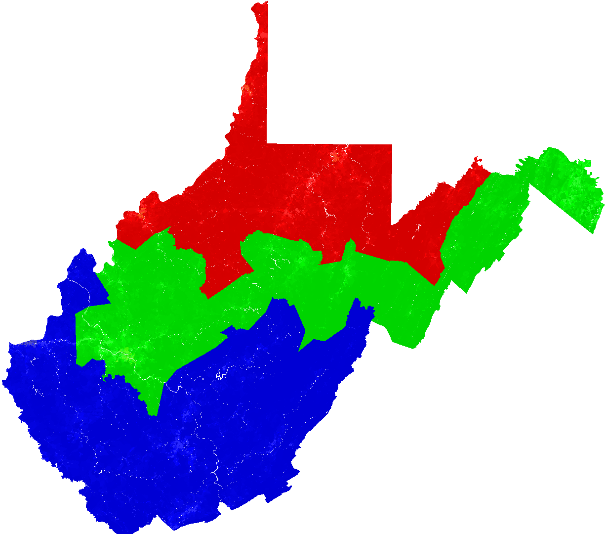
West Virginia Congress possible district map from my solver.
Larger West Virginia Congress map
average distance between a voter and
the center of their district (in kilometers)
difference in population between
the least populous district and
the most populous district
standard deviation of
district populations
90.279349322167.980158

Population Race Breakdown Per District

totalwhiteblacknativeasianpacificothermixed
617476592381113711168313416013317931
6177205761782059013645768181348510154
61779857142931163125535048713039057
zipped csv block list for West Virginia Congress
West Virginia Congress from 2000 Census

Creative Commons License
This work by Brian Olson is licensed under a Creative Commons Attribution-ShareAlike 3.0 Unported License.